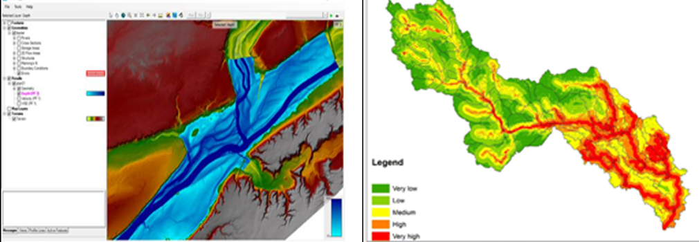
Flood-Hazard Mapping
At ME Consulting Engineers (MECE), we combine deep expertise in hydrology, hydraulic modelling, and river engineering to deliver comprehensive flood hazard mapping and river modelling services. Our work supports infrastructure planning, flood mitigation, and resilience across a wide range of geographies — from the UK to the Middle East (UAE & Qatar) and Africa.
What We Do
We develop and refine high-quality flood models and flood maps using leading hydrological and hydraulic modelling tools, supporting:
- Urban & regional flood risk mapping
- River system and catchment-scale modelling
- Flood defence planning and breach simulation
- Site-specific Flood Risk Assessments (FRA)
- Flood mitigation & drainage impact assessments
- Hydraulic structure design (culverts, bridges, weirs, embankments)
Tools & Technical Expertise
We use the latest 1D and 2D modelling tools for detailed flood simulations, including:
- HEC-RAS (1D/2D hydraulic river modelling)
- InfoWorks ICM
- MIKE Flood / MIKE 11 / MIKE 21
- TUFLOW / TUFLOW FV / ISIS-TUFLOW
- WMS (Watershed Modelling System)
- Surface and terrain data (TIN, DEM, DTM) from LiDAR, photogrammetry & satellite
We can build models from scratch or refine existing models sourced under license from:
- The Environment Agency (EA)
- Local Authorities
- Municipal agencies and ministries in the Middle East and Africa
Applications of Flood Modelling
We deliver a wide range of flood hazard modelling services:
River Modelling & Floodplain Analysis
- River hydraulics for natural and engineered channels
- Floodplain mapping for urban, rural, and undeveloped areas
- Analysis of flood extents, depths, velocities, and hazards
- Simulating backwater effects, bridge constrictions, and channel improvements
Breach & Overtopping Simulation
- Simulation of dam or embankment breach scenarios
- Analysis of coastal or fluvial overtopping impacts
- Inundation modelling for emergency response and resilience planning
Design & Assessment Modelling
- Hydraulic modelling to support Flood Risk Assessments (FRA)
- Design of culverts, crossings, flood storage areas, and defences
- Gauging station calibration and rating curve development
- Benchmarking and troubleshooting flood forecasting models

Expertise Across Regions
United Kingdom
- Flood hazard mapping compliant with NPPF, NPPG, and TAN15
- EA consultation and model licensing
- Localised surface water flooding assessments using 2D modelling
- Support for Flood Map Challenges and Sequential/Exception Tests
UAE & Qatar
- Flood hazard mapping aligned with Dubai Municipality (DM) and Ashghal standards
- Wadi flow simulations and flash flood risk mapping
- Integration with drainage master planning for mega-developments
- Emergency flood risk plans for critical infrastructure and high-density developments
Africa
- Catchment-wide flood risk mapping in support of World Bank and donor-funded projects
- Urban drainage and river flooding interaction in informal settlements
- Integration with climate resilience and disaster risk reduction (DRR) plans
- Capacity building with local universities and ministries
Knowledge Transfer & Training
MECE contributes to academic and professional development through:
- Lectures in hydraulic and hydrology modelling for MSc programs
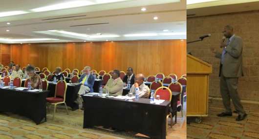
- Training workshops for government engineers and private sector professionals
- Documentation and manuals for model operation and updates

Photogrammetry & Topographic Modelling
In partnership with our specialist geospatial consultants, we offer:
- High-resolution surface models (TIN/DEM/DTM) using photogrammetry and LiDAR
- Asset-based modelling for dams, spillways, levees, and channels
- Integrated floodplain representation in 2D models
